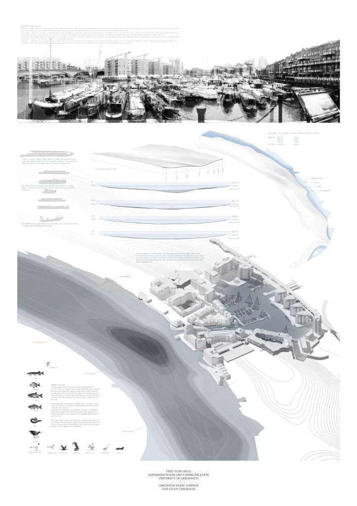
Limehouse, London
In this project I am exploring the Limehouse basin in the East of London. The project employs a number of techniques in order to document the site, its history and present.
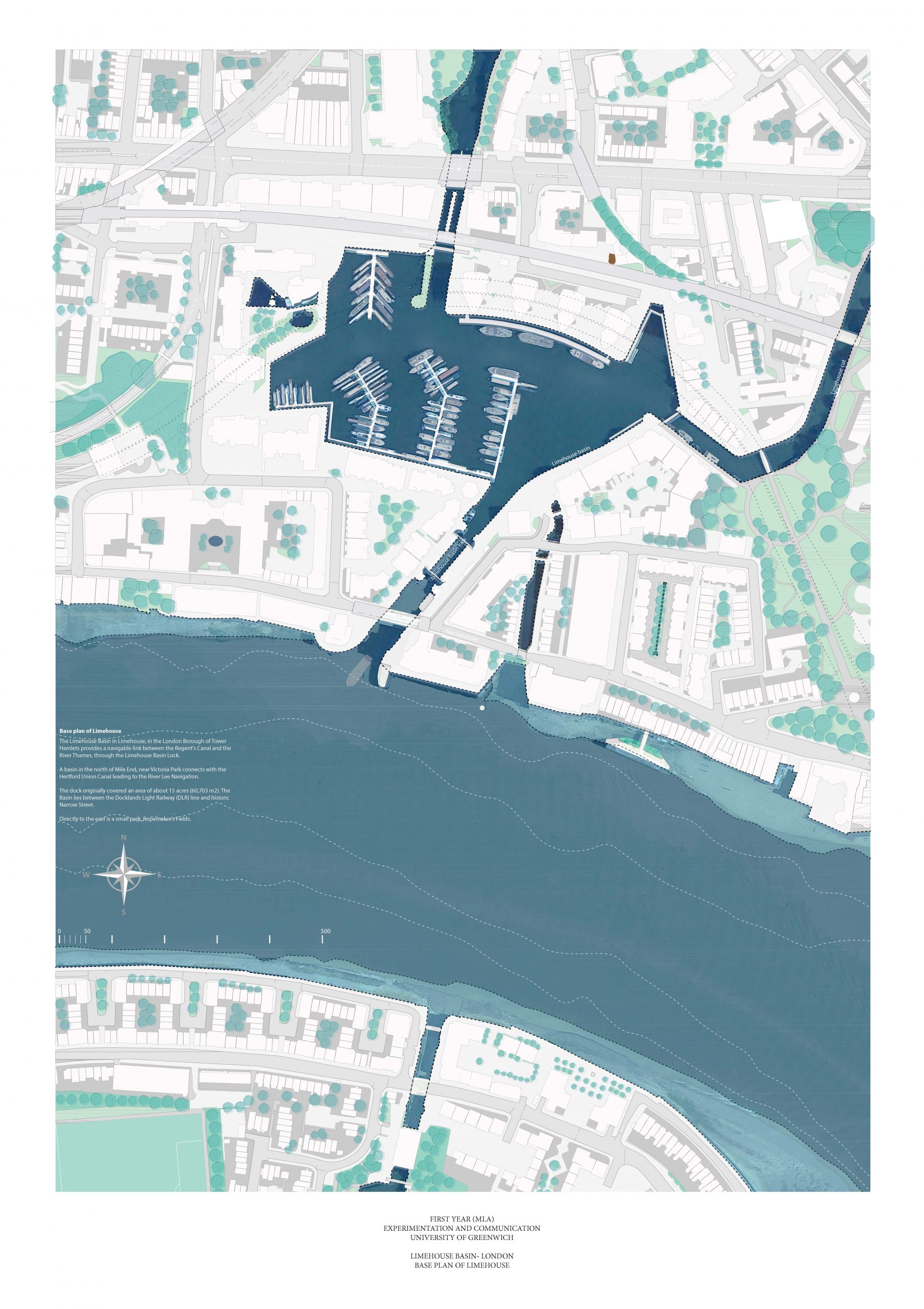
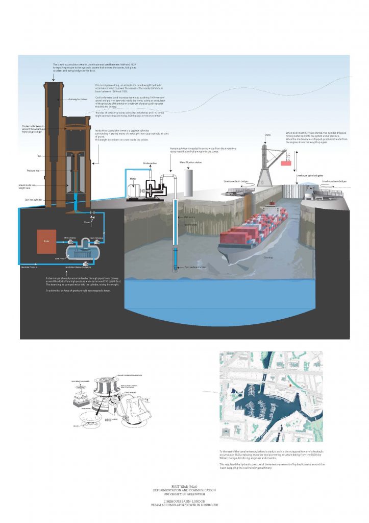
The project maps the invisible layers and reveals the operational character of the site.
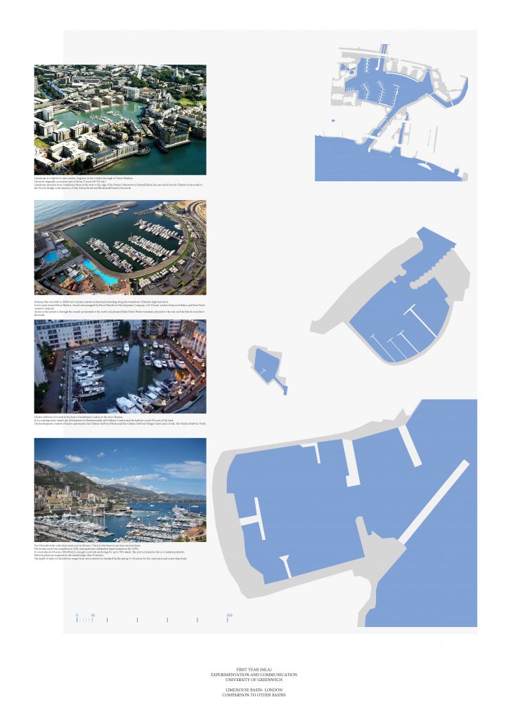
It explores the site through scale comparisons.
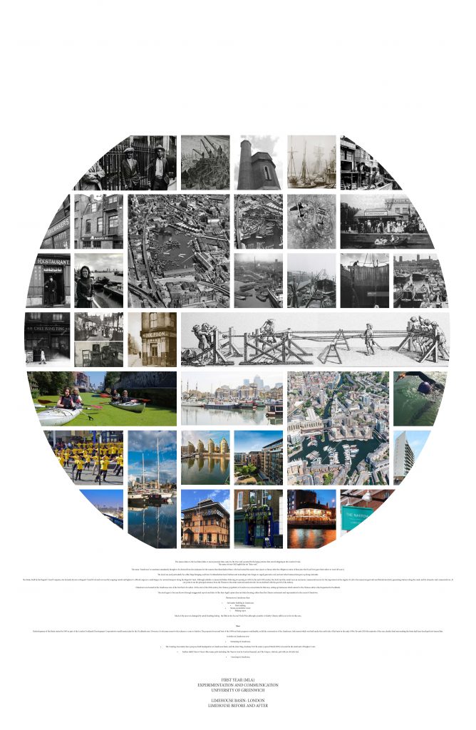
It develops polyptych images of the site.
The project offers two images of Limehouse: the first represents a high-resolution satellite perspective of the site and the second shows a diagram of my conclusions or observations from the aerial view.
It presents a view of River Thames including its edges, bank, piers, and buildings.
And finally the project offers a 3D representation of the site.